| Cotacachi |
|---|
A volcanic peak in Ecuador. Elevation, 4993 m. Latitude, 0° 22’ N. Longitude, 78° 21’ W. |
| The retreat of a glacier: |
|---|
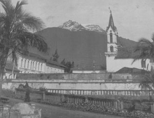 |
| The glacier circa 1900 (anonymous photo) |
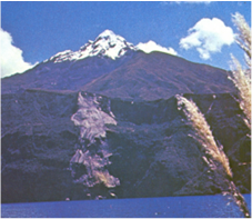 |
| Glacier-tipped Cotacachi in 1978 (photo by B. Wuth) |
|---|
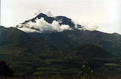 |
Cotacachi in 2000, with last fragmentary ice fields not visible in photograph (Cdrc 1997 used with permission) |
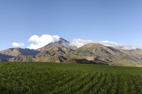 |
The darkened volcano in 2004 (photo by U. Merkel) |
Time of glacier's final disappearance: 2005-06 |
|
The loss of the glacier has contributed to the drying of streams and the falling level of a lake high on the mountain. The indigenous peasant farmers high up on the slope and the commercial farmers lower down have less water to irrigate their crops, and conflict over water resources have become more acute. There is a cultural dimension to the loss as well. In local oral traditions, the mountain figures as a beautiful young woman, one of the wives or lovers of Imbabura, a peak just across the valley from Cotacachi; the loss of the permanent white covering suggests the loss of her beauty and of Imbabura’s love as well. |